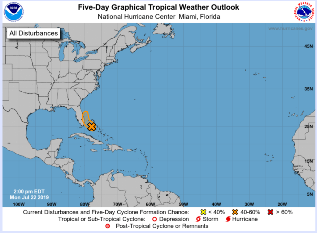
The Miami-Dade County Office of Emergency Management (OEM) is monitoring an area of low pressure (Invest 94L) located near Andros Island in the Bahamas. If this system further develops it could be named Chantal.
Current location: 24.6N / 77.5W (Approximately 100 miles East of Miami-Dade County)
Maximum Sustained Wind Speed: 30 MPH
Forward Speed: - - MPH

Forward Direction: NW
Potential for further development or weakening: While environmental conditions are only marginally conducive for development, only a slight increase in the organization of this system could result in the formation of a tropical depression later today or tonight. The low is expected to move northwestward today and northward tonight and Tuesday. By Wednesday, the system will have merged with a cold front and development will no longer be a possibility.
Potential Impact for Miami-Dade County: Although the system is expected to remain offshore the approach and passage of this system could bring increased coverage of showers, thunderstorms and wind gusts across South Florida tonight and through Tuesday. The main concern will be the potential for locally heavy rainfall (1” - 3”) and street flooding, especially along the east coast. Any westward shift of the system may bring a higher flooding risk.
